digiKam/Геоприв’язка фотографій за допомогою Android
Геоприв’язка фотографій знятих фотокамерою під керуванням Android за допомогою digiKam
Створено на основі допису у блозі Дмітрія Попова (Dmitri Popov), 29 жовтня 2012 року
Thanks to digiKam’s geocorrelation capabilities, you can geotag photos using a GPX file created with apps like Open GPS Tracker. But there is also another way to use your Android device for geotagging. The built-in camera app of most Android devices is capable of geotagging photos. This means that you can take a geotagged snap with the Android camera and then transfer geographical coordinates from it to other photos using digiKam. So next time, when you are done shooting with your main camera, remember to take a reference snapshot with your Android device (make sure that the geotagging option is enabled).

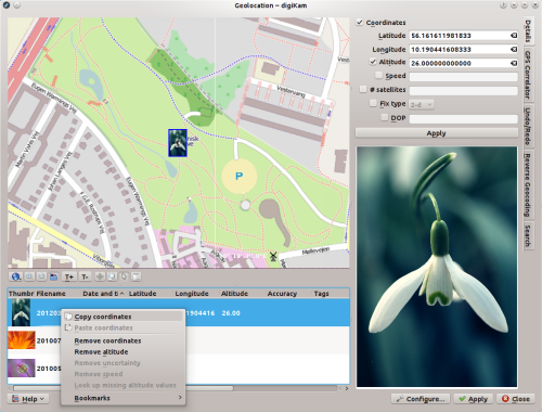
In digiKam, select the reference snapshot along with the photos you want to geotag and choose . Right-click on the reference snapshot in the selection list and choose . Mark then the rest of the photos in the list, right-click on the selection, choose , press the button, and you are done.
